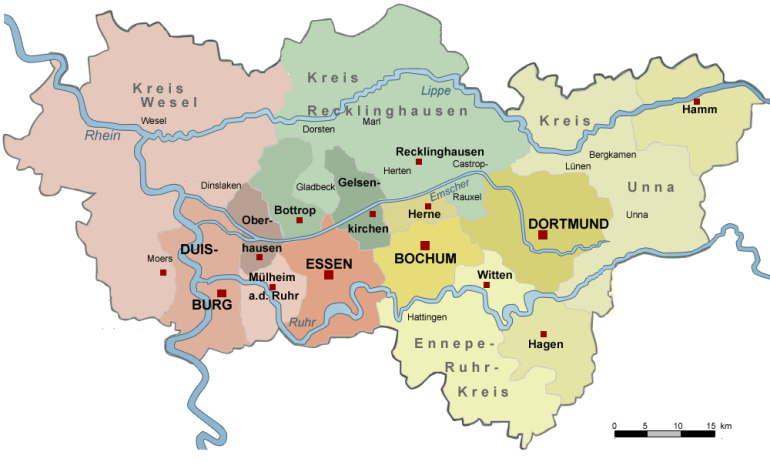
Karte
Aus Sagenhaftes Ruhrgebiet
(Unterschied zwischen Versionen)
(Die Seite wurde neu angelegt: „__NOTOC__ <imagemap> Image:Ruhrgebiet.png|770px|Ruhrgebiet poly 512 307 512 370 582 370 582 307 Verzeichnis Bochum poly 368 204 392 298 368 298 336 236 [[Verz…“) |
|||
| (Eine dazwischenliegende Version von einem Benutzer wird nicht angezeigt) | |||
| Zeile 1: | Zeile 1: | ||
__NOTOC__ | __NOTOC__ | ||
| + | |||
<imagemap> | <imagemap> | ||
Image:Ruhrgebiet.png|770px|Ruhrgebiet | Image:Ruhrgebiet.png|770px|Ruhrgebiet | ||
| − | poly 512 307 512 370 582 370 582 307 [[ | + | poly 512 307 512 370 582 370 582 307 [[Bochum]] |
| − | poly 368 204 392 298 368 298 336 236 [[ | + | poly 368 204 392 298 368 298 336 236 [[Bottrop]] |
| − | poly 656 226 780 274 708 367 627 297 [[ | + | poly 656 226 780 274 708 367 627 297 [[Dortmund]] |
| − | poly 241 272 300 294 310 437 235 417 [[ | + | poly 241 272 300 294 310 437 235 417 [[Duisburg]] |
| − | poly 601 359 661 390 611 509 541 471 [[ | + | poly 601 359 661 390 611 509 541 471 [[Ennepe-Ruhr-Kreis]] |
| − | poly 397 323 476 332 480 417 404 427 [[ | + | poly 397 323 476 332 480 417 404 427 [[Essen]] |
| − | poly 438 209 483 245 493 314 451 282 [[ | + | poly 438 209 483 245 493 314 451 282 [[Gelsenkirchen]] |
| − | poly 669 416 764 414 750 466 687 468 [[ | + | poly 669 416 764 414 750 466 687 468 [[Hagen]] |
| − | poly 844 104 963 125 935 199 847 173 [[ | + | poly 844 104 963 125 935 199 847 173 [[Hamm]] |
| − | poly 567 252 582 274 515 292 506 264 [[ | + | poly 567 252 582 274 515 292 506 264 [[Herne]] |
| − | poly 321 359 383 359 362 429 325 423 [[ | + | poly 321 359 383 359 362 429 325 423 [[Mülheim an der Ruhr]] |
| − | poly 325 256 361 315 329 339 313 268 [[ | + | poly 325 256 361 315 329 339 313 268 [[Oberhausen]] |
| − | poly 527 024 649 193 526 247 390 126 [[ | + | poly 527 024 649 193 526 247 390 126 [[Kreis Recklinghausen]] |
| − | poly 784 123 860 260 850 318 707 180 [[ | + | poly 784 123 860 260 850 318 707 180 [[Kreis Unna]] |
| − | poly 184 053 360 120 203 278 059 202 [[ | + | poly 184 053 360 120 203 278 059 202 [[Kreis Wesel]] |
| − | + | ||
</imagemap> | </imagemap> | ||
Aktuelle Version vom 7. Oktober 2010, 17:32 Uhr